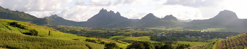
The Island
of Mauritius and the surrounding coral reef was created by volcanic
activity. Trou aux Cerfs is a now
dormant volcano crater that lies in the region known as Curepipe.
The
Distribution of Coral Reef surrounding nearly the entire island is due to
fringing reef. As the volcano erodes and
begins to shrink, coral starts to grow around it and the further the volcano
erodes the more the coral expands and forms a barrier.
(Aerial view of Mauritius and the
surrounding coral reef and coast lines.)
The coast
lines of Mauritius are varying and consist of sandy shores, rocky shores, muddy
shores, mixed shores, cliffs, wetlands, and a Calcarerous limestone shore.
Mauritius
Coastline
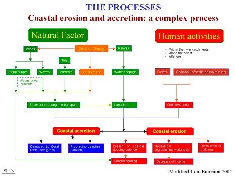
The varying coastal
varieties are due to coastal erosion either because of natural factors and/or
human activity.
The sandy
shores of Mauritius are composed of loose particles made up of various
sediments that have eroded over time and are of carbonate origin such as:
molluscan shells, crustose, sponge spicules, coral fragments, echinoderm
spicules, and calcareous algae.
(Mont Choisy
Beach, rated #6 on the top 20 Beaches of Mauritius)
Rocky
Shores, as seen on La Cambuse Beach, occur because of volcanic outflows into
the ocean. Rocky Shores can also be seen
on the West coast of the island between Flic en Flac and Albion.
(La Cambuse Beach, located on the
South Western Coast)
The muddy
shores of Mauritius consist of clay, fine sand, and silt often presented parallel
to the coast where deep channels form
{Black River, a part of the
Riviere Noire district on the western side. (Photo courtesy of Shutterstock.com)}
An example of a Mauritius stretch of shoreline
can be seen in the Roche Noire regions on the upper eastern coast of the
island, consisting of rocky, sandy, and muddy cliffs with pocket beaches.
(photo Courtesy of Mauritius tourist guide.com)
A cliff
shoreline can be seen in Souillac, with low and high cliffs that occur due to
natural erosion.
(Souillac Region, located on the southernmost
tip of the island)
Pointe d’Ensy,
located on the western shores of the island, is classified as wetlands
shoreline. With low-lying shores, the
area floods at high tide and as the water recedes the shore becomes
exposed. With mangroves, the shore
consists of silt and clay.
{Google image of Pointe d’Ensy
(photo courtesy of annikakinch.com)}
The last
Mauritius characterized shoreline, is a Calcareous limestone shore. This type of rock is classified as a coarse
sedimentary carbonate that is exposed and raised. It becomes eroded due to the fluctuation of
the ocean sea levels and causes jagged and sharp structures
{Angasa
Balaclava Mauritius (photo courtesy of Tripadvisor)}
Works Cited:
Allen, Casey. "Lecture 12: Rock Basics...background to Understand Earth's Landscapes." Lecture.
Allen, Casey. "Lecture 22: Coastal Landscapes and Processes." Lecture.
Et. Island Studies Journal, Vol. 6, No. 2, 2011, Pp. 157-178. Web.
Mauritius. Digital Images. Google.com. Web.
Onaka, Susumu, Hiroshi Hashimoto, S.r. Nashreen Banu Soogun, and Amit Jheengut. "Coastal Erosion and Demonstration Project as Coastal Adaptation Measures in Mauritius." Handbook of Coastal Disaster Mitigation for Engineer and Planners (2015): 561-77. Web.
Prasetya, Grega. "Chapter 4 Protection from Coastal Erosion." Regional Office for Asia and the Pacific. Web. Apr. 2017.


