Beginnings, Climate, and Landscape:
Mauritius has been known to have formed like other similar
islands, known as Oceanic islands, formed by volcanic activity. It was believed that Mauritius formed by the eruption
of lava under the sea floor, and the lava rose to the surface of the ocean and
cooled quickly to form rock and over time an island. However, recent scientific discoveries have
changed previous notions that Mauritius “came into existence…only nine million
years ago.” Crystal Zircon has been
found on the beaches of Mauritius that dates back to 1.5 billion years old,
suggesting that Mauritius is older than scientists believed and “could be over
84 million years old” and that there is “existence of a prehistoric continent
beneath the island and which extends thousands of kilometres in the depths of
the Indian Ocean up to Seychelles.”
The island experiences a mild maritime, mT, climate the entire year. Due to the
islands location between the Equator and the Tropic of Capricorn (south-West
Indian Ocean), cyclones can occur between its’ summer months November through
April; which creates a hot and wet weather pattern and this location is known
as the “cyclone belt.” Cyclones reaching
the land of Mauritius are rare and mostly remain over the sea, so the island
only experiences the edge of the storm.
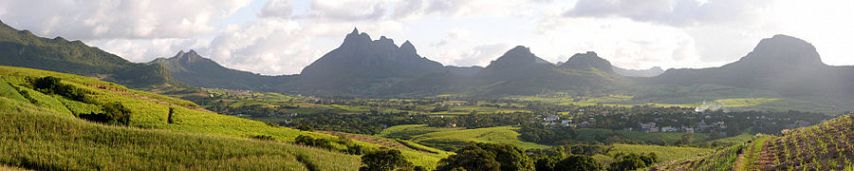
The physical aspects to Mauritius
include large coral reef surrounding the island and mountains located in
various parts of the island: Piton Riviere Noire, Mauritius’ highest peak with
2,700 feet in elevation, Pieter Both 2,670 feet high, and Piton du Millieu
1,930 feet high (just to name a few).
The island is described as “picturesque, the scenery varied and beautiful
[;] the upper parts of these mountains are generally bare basaltic columns:
there are many extinct craters and caves of great extent.” (pg. 286)
References:
"Geography of the Sea: Volcanic Islands." Extreme Science.
"Islands in the Southern Indian Ocean, Westward of Longitude 80' east, Including Madagascar. "Google Books. J.D. Potter 1891, 21 Nov. 2008. Web. 06 Mar. 2017.
Louis, Linley Bignoux in Port. "The New Find That Could Rewrite Mauritius' History." Africa Review. Africa Review, 19 Mar. 2013. Web
http://www.islandsonly.com/mauritius/climate.htm